30% Off 1 Bedrooms In July! – Learn More
Speak to an agent today 800.204.5169

Hiking

Gatlinburg Hiking

Gatlinburg, Tennessee sits at the main entrance to the Great Smoky Mountains National Park, so you’re only minutes from great hiking trails–several accessible right from downtown Gatlinburg. The Great Smoky Mountain National Park has over 150 trails to choose from with over 800 total miles of hiking trails. While staying in one of American Patriot Getaways’ luxury chalets, condos or cabins in Gatlinburg, Tennessee , choose from one or more of these hikes to see why these are the “Great” Smoky Mountains and make your visit unforgettable. Also, please call us if you have any questions about the hiking or about renting one of our Gatlinburg cabins.

Please take care when setting out into the National Park for a hike. Here are a few things you will need to know before you go!

  • Always hike with another person.
  • Always bring a small flashlight.
  • Always bring water.
  • All water taken from the backcountry should be treated.
  • Let someone know your route and return time.
  • Wear appropriate shoes.
  • Carry a small first aid kit.
  • Be informed about the weather & be prepared for quickly changing conditions. Check current weather conditions.
In downtown Gatlinburg, turn at stoplight #8 onto Airport Road. At the intersection, continue straight into the Great Smoky Mountains National Park. Continue until you see the sign for Roaring Fork Motor Nature Trail. It’s a narrow one-way road that meanders through great forests and parallels Roaring Fork Creek near Gatlinburg that is referred to as a “motorized nature trail“. Because it’s narrow and winding, motor homes, buses and trailers are prohibited. There are several pull offs where you can stop and enjoy or photograph the brilliant colors that Gatlinburg has to offer. Nature trails and hikes also originate from the main road, including hikes to Rainbow Falls, Grotto Falls and Mt. Le Conte for those with a bit more adventurous spirit. Several historical pioneer structures have been preserved along the road for exploration, and other points of interest include the Reagan tub mill where corn meal is ground and a waterfall called “Place of a Thousand Drips”–an extraordinary sight when it has been raining. This drive is roughly ten miles and takes the better part of two hours to truly enjoy this tour, depending on traffic. There are several other Auto Tours in Gatlinburg, when you need a break from hiking.    

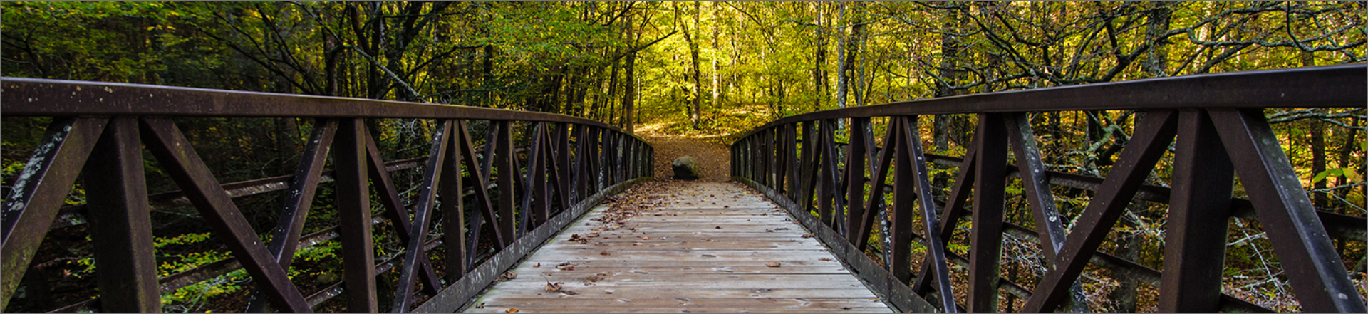
This easy 3.8 mile round-trip hike runs from the Sugarlands Visitor Center (also a must-see before you do anything else in the Park) to Gatlinburg Tennessee and back. This is one of the few trails in the Park that allows dogs (on a leash) and bicycles.

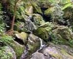
Described as moderate in difficulty, this 4-mile roundtrip hike rewards the hiker with a visit to one of the favorite waterfalls in the Park. This trailhead is very busy during the summer and weekends year-round. Access to the trailhead is via the Little River Road halfway between the Sugarlands Visitor Center and Elkmont Campground. Hikers can travel an additional 0.75 mile beyond the falls to see an old-growth forest.

From the Sugarlands Visitor Center, 2 miles south of Gatlinburg, drive 8.6 miles east on Newfound Gap Road. There you will find two parking areas, where a gravel path leads to The Grassy Patch and the beginning of a 2.3 mile hike to Alum Cave Bluff. This moderately difficult hike is 4.6 miles round-trip or 5.1 miles on to LeConte Lodge. The round-trip to the cave bluff takes about 2 and 1/2 hours, but allow about 3 and 1/2 hours to LeConte Lodge. The Alum Cave Trail is the most popular and well-known route to Mount Le Conte. Features include Arch Rock, 1993 summer storm damage, Inspiration Point, Alum Cave Bluff.
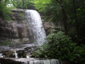
The Rainbow Falls Trail is fairly challenging if completed all the way to Mt LeConte. Allow an hour and a half to Rainbow Falls and four hours to Mt LeConte. Hikers will gain nearly 4,000 feet in elevation by the time they get to Mt. LeConte. The point of departure is at Cherokee Orchard Road – Turn at light #8 in Gatlinburg and follow the Airport Road 1 mile out of Gatlinburg into the Great Smoky Mountains National Park. The name will change from Airport Road to Cherokee Orchard Road. About 2.5 miles after entering the Park, Cherokee Orchard Road approaches the Rainbow Falls parking area. You will find the trail head at one edge of the parking area. Features of interest include the 2.8 mile point when you arrive at Rainbow Falls. At the 6.6 mile point you will come upon an Alum Cave Trail junction which leads left 0.1 mile to the LeConte Lodge.
Described as strenuous in difficulty, this 4-mile roundtrip hike is short and very steep. But, don’t let the quick ascent detour you from one of the Smokies finest views. Relatively easy for the first mile, you will endure a 600-yard climb to the Chimneys before experiencing a breathtaking view that rivals any other. This trail is not particularly dangerous, but is not recommended for small children. Follow US 441, Newfound Gap Road, through the Park to the trailhead with signed parking area on Newfound Gap Road, approximately 6.5 miles south of Sugarlands visitor center at the north entrance and 5.5 miles north of Newfound Gap.

Described as easy in difficulty, this 2-mile roundtrip hike is on a wide trail with a paved course that is easily accessible with a wheelchair or stroller. Rest room facilities and benches assist in navigating the path. When you reach the summit, you will be standing on the second highest peak east of the Mississippi River. The tower is reached via a wide ramp, making this trail an immediate favorite amongst families and groups with children. To get to Clingmans Dome, you want to be on Newfound Gap Road (the only road which completely traverses the Park). One-tenth of a mile south from Newfound Gap you will turn onto Clingmans Dome Road. From there, you’ll travel 7 miles, passing several pullouts for views, and end up in a parking area from which you walk a short distance to the top of the mountain. The turnoff to Clingmans is about 25 miles from Cherokee or 22 miles from Gatlinburg. Open from April through December, the road to Clingmans Dome is closed in winter.

Cades Cove hiking trails include: Abrams Falls, Ace Gap, Anthony Creek Trail, Beard Cane, Bote Mountain, Cades Cove Nature Trail, Cane Creek, Cooper Road, Crib Gap Trail, Gregory Bald Hiking Trail, Gregory Ridge Hiking Trail, Hannah Mountain, Hatcher Mountain, Indian Grave Gap, Little Bottoms, Rabbit Creek Hiking Trail, Rich Mountain Loop Trail, Rich Mountain Trail, Russell Field, Scott Mountain, and Wet Bottom horse trail. Cades Cove is also a wonderful trip by car for a relaxing Auto Tour.

To get to Cades Cove from Pigeon Forge, turn at Traffic Light #3, Wears Valley Road, travel approximately 14 miles to Townsend, Tennessee. From Townsend turn left onto 321 and follow the signs to Cades Cove.

From Gatlinburg, travel 2 miles on South 441 to the Sugarlands Visitors Center, turn Right onto Little River Road. A couple of miles into the ride you will come to the parking area for Laurel Falls, a truly magnificent double falls at the end of a 1 mile paved hike. After this amazing pit stop continue on the scenic drive on Little River Road through the national park to Townsend, Tennessee. From Townsend, Tennessee, enter the Great Smoky Mountains National Park and turn right at the “Y” onto Laurel Creek Road towards Cades Cove.

The Abrams Falls hike begins at a field at stop number ten on the Cades Cove loop. The waters at the destination of this hike, Abrams Falls, make an interesting 20-foot drop to the pool and stream below. The path from the Cades Cove valley floor to the falls high above roughly follows Abrams Creek. The hiking trail weaves up and down, back and forth along the ridges surrounding that end of Cades Cove. Though the hike to the falls is relatively short, for most Smokies Visitors the hike is challenging but rewarding. The walk to Abrams Falls trail is definitely well worth the effort up and down the ridges as attested by the trails popularity–nearly 1000 visitors per day in peak season. On the Abrams Falls trail, the Smokies visitors gets to enjoy the majesty of the Smoky Mountains, rhododendron lined footpaths, as well as the twenty-foot Abrams Falls. The total hike is five miles in length (roundtrip) and climbs approximately three hundred and forty feet up the mountains of Cades Cove. To get to the Abrams Falls trailhead, go five miles on the Cades Cove Loop Road and after crossing Abrams Creek, turn right on a gravel road which runs through a grassy field. Park at the back of the field where there are signs and a marvelous wooden bridge that mark the beginning of the hike.
The Ace Gap hike is one of the most peaceful trails that Cades Cove has to offer. It is about five and a half miles in length, without much altitude gain or loss. In the month of May, parts of the Ace Gap trail are strewn with pink Lady’s Slippers. All wildflowers in Cades Cove are protected by law and may be admired and photographed, not picked or dug. The trailhead to Ace Gap trail is down Cades Cove loop and up Rich Mountain Road. Near the trailhead, Smokies hikers pass Bull Cave, the largest cave in Cades Cove. The bottom of the cave is fully five hundred feet from the surface almost straight down. Smokies hikers on the Ace Gap trail will ascend from the Cades Cove floor past the mouth of the cave. Once beyond the cave, the trail meanders five miles along the ridges of Rich Mountain to the place known as Ace Gap. Ace Gap was so named for card playing loggers that once congregated there. You will know you have come to Ace Gap when you come to an old railroad bed. Logging trains once clacked along railroad tracks all over Cades Cove during the expansion of the United States. Cades Cove and many other parts of the country yielded up virgin forests while filling a seemingly endless demand for lumber for homes, buildings and bridges. The trains which once traveled along the Ace Gap track were owned by the Little River Lumber Company and carried equipment, loggers and logs through Cades Cove.
The Anthony Creek Trail starts at the beginning of the Cades Cove in the picnic area and goes three and a half miles up Bote Mountain for a 3000 altitude gain. Hikers should anticipate the need for water as this can be a strenuous hike. Despite the difficulty of the hike, Smokies visitors using the Anthony Creek trail enjoy beautiful scenery as well as wonderful views from Spence Field and Rocky Top, both locations being important in Cades Cove history. To get to Spence Field and Rocky Top you travel the Anthony Creek Trail to the Bote Mountain Trail and the Appalachian Trail. Anthony Creek Trail also features the headwaters of Anthony Creek. The popular Cades Cove trail also goes by the horse camp, a delight to horsemen as well as goes by backcountry camp sites. Due in part to the location of the trailhead, the Anthony Creek Trail is one of the most traveled in Cades Cove.
Beard Cane trail is named for a cane variety which grows locations in Cades Cove where the terrain is moist. The Beard Cane trail is one of a few relatively flat trails in Cades Cove and for that reason it is wonderfully suitable for an amble in the woods. An easy hike that takes the Smokies visitor down the hollow between Beard Cane and Hatcher mountains, the Beard Cane trail is known for being beautifully strewn with wildflowers and flowering shrubs such as polygala, trillium, rhododendron, and dog-hobble. Overhead trees such as oak, tulip, hemlock and maple trees canopy this Cades Cove hike. Try not to go after a rain however as the Beard Cane Trail, can be very muddy after rains.
During the 1800’s, James Spence tended the Cades Cove farmer’s cattle in an awe-inspiring mountain meadow. Eventually the meadow became known as Spence Field. Hikers who take the Bote Mountain trail and hike all the way to the Spence Field will do so through intermittently rocky terrain and rhododendron covered footpaths. On the climb up the Bote Mountain trail, Smokies hikers can envision James Spence and the Cades Cove farmer’s cattle he tended climbing the slopes in yesteryear. Driving the cattle on such a climb must have been difficult, but the grass at the higher elevations made the effort worthwhile. Nutritionally, the high mountain grass was better for the cattle than that found on the Cades Cove valley floor. In addition, the cattle faired better at the higher location due to a considerable reduction in heat and flies. Many a Smokies hiker who hiked up the Bote Mountain trail has come to look upon James Spence as a lucky man, for he spent so much of his life overlooking Cades Cove from his mountain paradise. From Spence Field today, trees are cleared so those Smokies hikers see Cades Cove, Lake Fontana, Rocky Top and other notable landmarks of the Great Smoky Mountain National Park. By reason of its view alone, Bote Mountain trail is one of the most rewarding to originate in Cades Cove.
The Cades Cove Nature Trail is particularly beautiful in the spring when the dogwoods bloom and also in the fall when the sourwoods and maples turn a beautiful red. This Smokies trail one of the best hikes for those who want to stretch their legs, learn about Cades Cove via brochure, and yet not get tired out. On the Cades Cove Nature trail you can see what remains of what was once a thick chestnut grove in the 1800’s. Almost one third of the forest surrounding Cades Cove’s was made up of Chestnut trees at that time. Chestnut groves were used so advantageously by both Cades Cove mountain farmers and wildlife alike. Now only chestnut sprouts grow from the vast chestnut root system of the giant trees which were once plentiful in Cades Cove. Today the large trees growing along the Cades Cove Nature Trail are primarily oak, dogwood, sourwood, and pine trees. What killed the chestnut trees of Cades Cove? They were hit by a blight which killed chestnut trees throughout the Great Smoky Mountain National Park, taking with them long standing traditions of mountain men and wildlife alike. The groves were an integral part of the mountain people’s yearly life cycle. Mountain farmers used the groves to fatten hogs for slaughter and to gather them for human and livestock use or sale. In Cades Cove, bears once used to frequent the majestic stands of chestnuts trees that were a main source of fall mast. The chestnuts allowed Great Smoky Mountain National Park bears easy access to high calories as they tried to fatten themselves for hibernation. Today, acorns take the place of chestnuts in Smoky Mountain Black bear diet, but is considered a poor substitute by park officials.
Cane Creek trail is one of the easiest Cades Cove trails to get to but involves hiking part way up the Cooper Road Trail to get there. The Cane Creek hike is only two miles long and goes through the Cane Creek bottoms (lowlands). The trail goes through land that was once farmed by the Buchanan family but has reforested over time. Features of this hike include eastern Hemlocks and hardwood trees, the Buchanan family cemetery, and a very pleasant, lightly used campsite at Cane Creek. Be aware that many low lying trails are often muddy.
Cooper Road trail offers the Smoky Mountain hiker and horseback rider solitude and an easy path. The trail goes to the park boundary about ten miles away from the trailhead. If you hike or ride the Cooper Road trail in Cades Cove, you will follow in the footsteps European descent pioneers and Native Americans alike as the Cooper Road trail follows a Smoky Mountain Indian trail that was later improved into a road in the 1830’s. In the 1840’s, the road was renamed for Joe Cooper who improved the road for wagon travel in the cove. Cooper road was the best way for pioneers who lived in the west part of the cove to get through the Smokies to Maryville. Early Smokies pioneers in Cades Cove grew, made, or hunted just about anything they might want or need and so a trip to Maryville did not need to be made too often. The cove residents went to town for reasons such as, to go to Crawford and Caldwell hardware store or to go to a doctor or to visit a family member. Some others collected chestnuts in one of the many chestnut groves that were prevalent in Cades Cove in those days. After bushels of chestnuts were gathered, a trip from the cove to Maryville would insure a good market for the chestnut crop.
Crib Gap trail is actually a horse track that may also be used by people who want a short hike in Cades Cove. Crib Gap was once the main entrance into Cades Cove from Big Spring Cove on the other side of the mountain. Now only Great Smoky Mountain National Park trails come through the area, one of which is Crib Gap trail. Crib Gap trail begins on the left side of the Cades Cove Picnic ground and ends as it crosses the Turkeypen Ridge Trail, approximately one and a half miles away. The beginning of Crib Gap trail follows Anthony Creek. As are all the lowlands in Cades Cove, the part of the trail by Anthony Creek is a bit muddy. Hemlocks, so common in the Smoky Mountains grow thickly along the creek but as the trail rises, the hiker climbs to a much dryer pine and oak forest.
Gregory Bald is a high meadow that was used in the summer for cattle grazing by the Cades Cove farmers. There are several trails that go to Gregory Bald. This particular trail affords a steady four and a half mile climb to the bald through pine and hardwood forest. On the way to Gregory’s Bald, Smokies hikers will go through Sam’s Gap, Panther Gap, and Sheep Pen Gap Backcountry Campsite. From Gregory’s bald there are magnificent views of Cades Cove as well as other surrounding landmarks. The Gregory Bald trail continues past the mountain meadow until it ends at the Appalachian Trail. Ambitious Smokies visitors can hike on to the Appalachian Trail, however keep in mind it is seven and a half miles from the trailhead. A hard days hike is eight to ten miles, so going all the way to the Appalachian trail and back is definitely not a day hike. To get to the Gregory Bald trail, go down the Cades Cove Loop to the Visitor Center at Cable Mill and follow the signs to Parsons Branch Road. Sam’s Gap where the Gregory Bald Hiking Trail begins is five miles down Parsons Branch Road.
At the Cades Cove Visitor Center take Forge Creek Road until you come to the end. Here you will find one of several trails up to Gregory’s Bald. The hike features Gregory’s Bald, virgin forest with huge tulip trees, flame azaleas and the highly used campsite number thirteen. Gregory’s Bald is one of the high mountain meadows where Cades Cove farmers took their cattle to escape summer heat and flies. Gregory Ridge trail will take seven or eight hours to complete, so be prepared for an arduous hike should you choose it. It may be the most arduous hike in Cades Cove. Gregory Ridge Trail is a good choice if you want your hike’s destination to have a good view of Cades Cove. So many Smokies visitors hike up the Gregory’s Ridge trail for that reason, that it is one of the most popular trails in the Great Smoky Mountain National Park. The trail winds through some of the best of Great Smoky Mountain National Park, delightful old growth forest and azalea covered Gregory’s Bald. In azalea season the experience of Gregory’s bald is unmatched, for it is ablaze with breathtaking masses of orange and wine colored blooms, but in the days of old, Cades Cove farmers used to graze their cattle on Gregory’s bald, cattle being one of their best cash crops. To get to the Gregory Ridge trailhead, turn right out of the Cable Mill area parking lot and proceed to Parson Branch road. The parking area marked Gregory Ridge Trail is about five miles down at Sam’s Gap. Gregory Ridge trail is one of Cades Cove’s most strenuous climbs being four and a half miles up the mountain, but it is well worth the effort.
The Hannah Mountain trail runs high along a ridge over Cades Cove beginning at Sam’s gap and continuing nine and a half miles to Abrams Creek. As eight to ten miles is a very long hike for most people, you probably won’t hike the entire Hannah Mountain trail unless you are a serious backpacker used to camping in the back country of the Great Smoky Mountain National Park. This trail is known for its beautiful views of Cades Cove from the grazing land on the crest of Hannah Mountain. One of the notable features of the Cades Cove trail is an enormous tulip tree two miles from the trailhead. It stands majestically on the right, measuring ten feet in circumference. The Hannah Mountain trail has an enjoyable atmosphere, good even footing and historical significance. Long before the Great Smoky Mountain National Park was formed, Cherokee Indians working for Daniel Foute dug Hannah Mountain trail in the 1840’s. He was the owner of the Montvale Resort on Chilhowee Mountain. Foute’s purpose in building the trail was to connect his resort to beautiful Gregory’s Bald. His trail to Gregory’s Bald was a powerful draw for his resort, especially when the azaleas were blooming in the meadows above Cades Cove. The popularity of the Hannah Mountain trail was in part responsible for the resorts long life, bringing Smokies tourists to the mountain meadows of Cades Cove for better than one hundred years. To get to Hannah Mountain trail you must take the Cades Cove Loop past Cable Mill area. Follow the signs to Forge Creek Road that runs into Parson Branch Road. Travel approximately four miles to the trailhead.
Skip to content